Irrigation and underground water
Mark and display irrigation zones, solenoids, and waterlines clearly on your map.
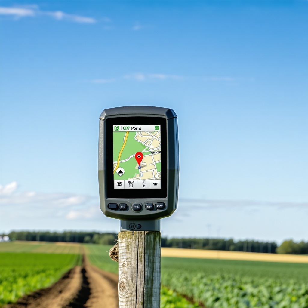
Use GPS to locate underground infrastructure and ensure efficient maintenance and planning.
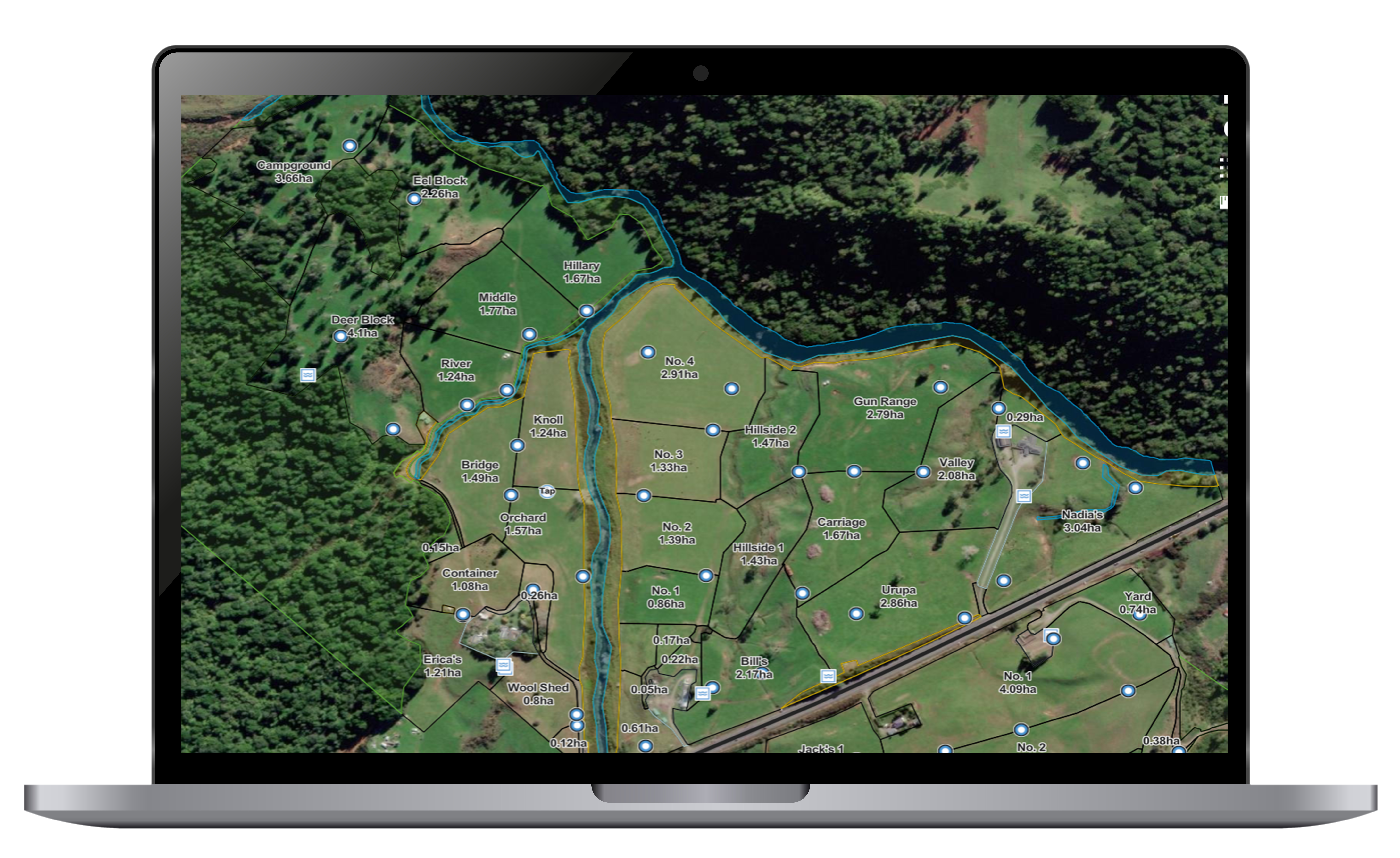
• Create precise digital paddocks by using GPS drone or satellite imagery.
• Plan your rotation and manage pastures with ease. Quickly split paddocks to set up accurate temporary fencing.
• You can update boundaries, size changes, or land-use alterations instantly.
• Clear visibility of paddocks aids in planning crop rotation, grazing, and machinery use.
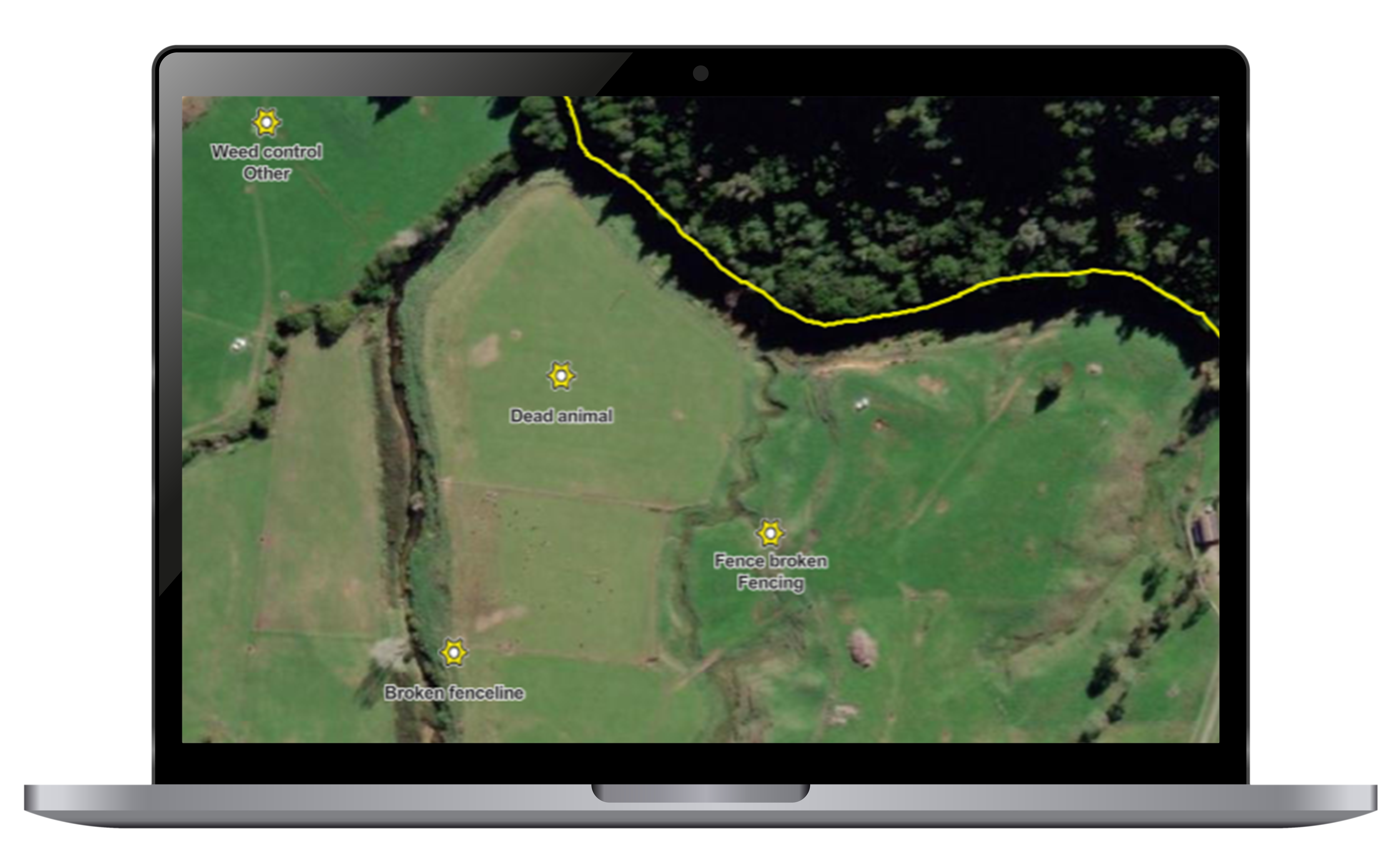
Capture tasks on the farm by adding the location and photo to your map to summarise issues. Use GPS to direct your staff straight to the problem.
Select the layer of information that you want to view, and use the map on your phone to take you straight to what you are looking for.
.png)
Landkind’s map-based platform brings farm data to life, enabling new ways to view and share information.
Our easy-to-use tools and integrated data will help you make confident, informed decisions, saving you time and increasing efficiency across your business.

• Record data directly on the farm using mobile devices.
• Tag photos, notes, and tasks to specific locations on your map.
• Log farm activities in your digital diaries using time stamps.
• Use GPS to track staff movements and task completion.
• Sync data automatically to the cloud for teamwide access.
• Generate reports for compliance, audits, and planning.
• Save data captured on a farm in the same place to retrieve easily and increase staff awareness.
• Improved decision-making with real-time, location-based data.
• Reduced paperwork through digital recordkeeping.
• Better traceability for compliance and food safety.
• Optimised labour and input use through targeted actions.
• Enhanced collaboration with shared access across teams.
• Historical insights to guide future orchard planning.
• Increased productivity by reducing time spent on administration.
• GAP compliance - produce your GAP map with a push of a button.
• Estimation map production: You can easily produce your own estimation maps using simple GIS tools.